Thenave Mars Expressfrom ESAcelebrate eight years in spacewith a new vision ofice in the south polar region of Mars during the spring of the red planet. The poles are closely linked to the Martian climate and constantly change with the seasons. Their study is an important scientific objective of the mission.
The image was taken in January 2011, during the southern spring of Mars. About two-thirds are covered by the South Pole ice sheet and other scattered ice deposits, in the vicinity of the so-called Ulysses Cliff (Rupes Ulyxis). With a length of 390 kilometers and a height of up to 1 kilometer, it is barely visible in the upper right of this image.
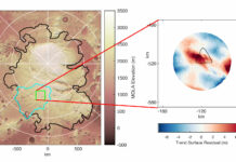
The left side of the image is dominated by the ice shield of the polar cap, which is covered by the dark dust material that hides the ice glow underneath. Here, more than 1,000 kilometers from the Martian south pole, the ice is relatively thin: radar data indicate that it is only about 500 meters thick, while near the south pole it can be more than 3.7 kilometers . Cliffs are often curved, which could mean they are made up of underlying impact craters. The elevation of this region decreases markedly from south to north, with a drop of about 1,500 meters from left to right in the image.
Just north of the ice shield, halfway through the image, there islarge ice deposits largely covered by molten material in the dunesswept away by the prevailing winds in this region. The orientation of the dunes suggests that the wind must come mainly from the northwest. With increasing distance from the south pole, the ice is limited to the largest impact craters. The ice itself is slightly displaced to the north, because in sunlight from the north, the crater walls to the south tend to get hotter, causing the ice to melt.
Mars Express
 ProbeMars Express, launched in June 2003 and which has been orbiting the red planet since the end of that year, has generated countless discoveries. This first European mission to Mars has obtainedStunning high-resolution 3D and color images of the Martian surface. In addition, it carries on board the first radar instrument that has ever flown over Mars, and whose subsurface soundings showunderground water ice deposits. The spacecraft has found mineralogical evidence for the presence of liquid water throughout the history of Mars, and studied the density of the planet’s crust in detail. It was also the first satellite to detectmethane in the atmosphere of Mars from its orbit, and pioneer in the observation ofauroras at mid-latitudes.
It is expected thatMars Expresshelp answer questions such as the possibility that water or life existed on Mars. In addition, you will map the Martian surface, atmosphere, and ionosphere from orbit and conduct observations and experiments on the surface.