Would you like to sail the depths of the Pacific Ocean without leaving your armchair ? Do you want to visit the underwater enclave where the next tsunami could originate? Oceanographers at the Lamont-Doherty Earth Observatory at Columbia University (USA) have made this possible by incorporating a detailed map of the ocean depths into Google Earth . The new topography of the seabed gathers scientific data collected over several expeditions and covers some areas with a resolution of up to 100 meters of detail.
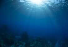
The "virtual travelers" who venture through Google Earth will discover spectacular underwater landscapes such as volcanic slopes, rugged peaks, mountain ranges, great plains, deep valleys, vents that expel hydrothermal waters … So far scientists have mapped 10% of the seafloor and only half of that data is available through Google Earth. Places of special scientific interest are marked on the map.